London: A city under threat
Maintaining the future security and prosperity of our growing coastal cities and survival of many unique coastal habitats requires scientists to deliver reliable sea-level projections on which to base adaptation, management, and protection plans for vulnerable coastal regions.
While there are many vulnerable coastlines around Europe, the city of London provides a crucial example of the threat of sea-level rise.
Global sea-level rise
Since the early 1990s global sea-level scientists have measured sea level around the world with great precision using satellites. The results show that on average global sea level is rising every year by around 3mm. But there is evidence that this rate has risen in recent decades, and by the end of this century a total sea-level rise of around 1 metre is possible, compared to 1990 levels.
As the daily tidal rise and fall around many coasts is more than 1 metre, the implications of a 1m rise in sea level are not necessarily immediately obvious. A true understanding of how serious this could be can only come from considering the statistics of risk.
London and the Thames

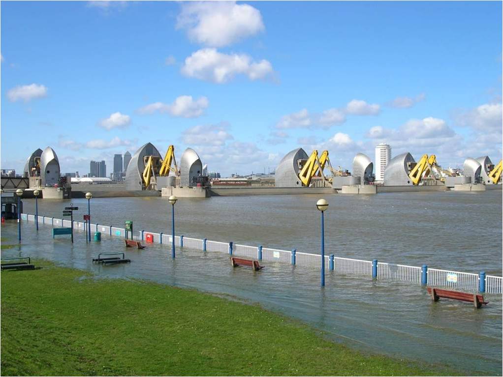
Barrier from Woolwich with flooding. Photo: Environment Agency (UK)
The city London lies along the River Thames. The location and shape of this estuary means that storm surges sweeping down the North Sea are sometimes magnified by the time they get to the city. Indeed, London has been flooded, or nearly flooded, several times in the last two centuries, and after each event the level of the flood defences has been raised. During the 1953 floods that killed 1,835 people in the Netherlands, London’s defences were within a few cm of being overtopped, and the British Government responded with a major programme of improvements in sea defence. Central to these was the Thames Barrier a massive series of gates between the city and the sea. When the Barrier was finally completed in 1984, it was calculated to provide London a level of protection that would likely be breached only once in 1000 years.
The Thames Barrier, and more than 100 km of addition sea defences that support it, still provide London with a high level of protection, but several factors, including sea-level rise, mean that this will not be maintained indefinitely. Without any improvement, a 50-cm rise in global sea level would reduce protection provided by current sea defences so that breach would be likely once every hundred years. A 1-m sea-level rise would reduce this protection even further, to once every ten years.
Managing Risk
Managing this risk, and improving sea defences to maintain levels of protection that are acceptable to citizens, business and government is the responsibility of the UK Environment Agency. The Environment Agency has published a plan (Thames Estuary 2100) showing how this risk can be managed through a combination of measures even in the face of extreme sea-level rise. However, even under moderate assumptions, this requires replacement of the Barrier at sometime during the century. Given that it will take many decades to plan, design, and build a replacement barrier and that replacement would be expected to last many more decades, the value to the Environment Agency of good sea-level projection is clear. Underestimation of the rise would leave London inadequately protected, over-estimation could mean over-specification of the replacement barrier, and excessive costs that could run into tens of billions of pounds.
Ice2sea will provide sea-level projections that will aid Environment Agency planners in maintaining levels of protection to the inhabitants of the city of London, and similarly vulnerable cities around Europe.


